


Marin County is in Northern California, and is home to plenty of beautiful attractions, including the Point Bonita Lighthouse, the Marin County Civic Center, the peaks of Mount Tamalpais State Park and multiple hiking, biking, running and walking trails of different skill levels. A paradise for hikers and mountain bikers, Marin County also boasts of rich and diverse wildlife, with redwood trees and beautiful birds of different species taking precedence over others. The trails are not just pretty (some are quite wild, as well), but they also offer amazing views of forests, coastlines, waterfalls and mountain peaks. Some of these trails are paved and some are left natural. All of these trails afford a unique experience, and if you’re prepared for a long halt, then you must explore all of these 10 best hiking and trekking spots in Marin, California.
1. Redwood Trail

The Redwood Trail is located near the Mill Valley. It is a 1.8-mile (3-kilometre) long trail, which is not too crowded nor too steep, and offers magnificent views of the hills. The trail is open all year round and features a variety of activities and special events, open to all. The pathway is covered with pretty Chaparral and Redwood shrubs, and the endpoint of the trail will lead you to the Muir Woods National Monument.
Redwood Trail
Address: California 94941, USA
2. Dipsea Trail

The Dipsea trail or Ben Johnson trail, unlike the Redwood trail, can get heavily crowded and is also located near the Mill Valley. This is a 9.7 miles (15.6 kilometres) long trail and is a difficult spot for hiking. You are likely to spot black tail deers and coyotes on your way. It is not meant for the inexperienced. You will pass by the Muir Woods National Monument, the Stinson Beach and the beautiful California redwoods to finally reach the peak, where there is a water fountain.
Dipsea Trail
Address: Muir Woods to Stinson Beach, Mill Valley, CA 94942
3. Panorama Trail

You can enjoy both a moderate and a difficult hike on this 8.5 miles (13.6 kilometres) long route called the Panorama Trail. Glacier point is a good spot to start if you want to experience a moderate hike. Witness the mesmerising views of Half Dome, the peaks of the Clark Range, the Yosemite Valley, the tallest waterfall in North America and the stunning dance of the male Blue Grouse trying to attract the female. You can also start at the Mist trail and continue to Glacier point by foot, instead of opting for a vehicle.
Panorama Trail
Address: Glacier Point Rd, Yosemite Village, CA 95389, United States
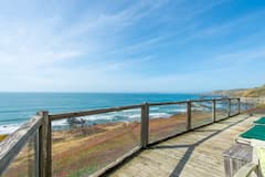
You might be interested in these Airbnbs!


4. Pirates Cove Trail
Pirates Cove Trail is a moderate-level trail. It is a 3.6-mile (5.8 km) long trail that is also perfect for a casual stroll. You can even get your dog on a leash to enjoy a walk with you. There is plenty of greenery around, with views of the ocean, and several birds flock here and there. On your way to the cove, you will encounter a rocky scramble, while otherwise, the trail is pretty flat with slight inclines. The best time to hike this trail is between the months of May and October.
Pirates Cove Trail
Address: Avila Beach, CA
5. Big Rock Trail
Big Rock Trail stretches for 4.5 miles (7.24 kilometres). It normally remains quite crowded. However, it is a great hiking-cum-mountain biking spot. It is pretty windy once you reach the top, even though it can get a little hot during the afternoon. It is really pretty along the way and is a mixture of steep and flat paths, with an increased steep near the top. So, the first half is relatively easy compared to the second half of the hike.
Big Rock Trail
Address: Santee, CA 92071, USA
6. Plankwalk Trail

The Plankwalk Trail offers amazing views of Farallon Islands, Marin County hills, Mount Diablo, San Francisco and the bay jutting out to the Pacific Ocean. The Trail starts at the summit of Mount Tamalpais. The first part, 0.1 miles, (0.16 kilometres) of the trail is made of planks. Mt. Tamalpais has a peak on the west and another on the east, while offering scenic views from the taller east peak, with a fire lookout. The trail is also surrounded by madrone, manzanita and chamise bushes.
Plankwalk Trail
Address: Near Larkspur California
7. Point Bonita Trail

The Point Bonita Trail leads to the Point Bonita Lighthouse. The best time to hike this trail is between the months of September and May. It is a 1-mile (1.6-kilometre) long trail which flanks beautiful wildflowers. You can easily get your kids to walk this trail with you, as the path is paved and offers both easy and moderate hiking options, with multiple paths branching out from the main path. The way to the lighthouse includes a tunnel and a suspension bridge, which is pretty exciting to cross.
Point Bonita Trail
Address: 94865, CA-1, Sausalito, CA 94965, United States
8. Fern Creek Trail

Fern Creek is a 3.1-mile (5-kilometer) long Trail, which is suitable for hikers of all skill levels. It is a good place to hike throughout the year. However, try and avoid the months between November and April, as it is the rainy season and the trail tends to get a little muddy. Start at the main boardwalk trail, from where the path for the Fern Creek Trail branches out. There are several tall trees, which adds to the gorgeous scenery and there are multiple creeks with bridges over them, along the way.
Fern Creek Trail
Address: Fern Creek Trail, California 94941, USA
9. Matt Davis Trail

This is a long trail spanning for 7.8 miles (12.6 kilometres). It is near Stinson beach and is suited mainly to moderate skill levels. It is a great place to watch different species of birds. If you’re a wildlife photographer, you are going to love it. The trail is accessible all year round. The peak offers stunning views of the ocean, and the trail features a number of gorgeous waterfalls, too. You start at the Pacific Ocean and finally reach the Muir Woods Visitor Center.
Matt Davis Trail
Address: Matt Davis Trail, Stinson Beach, CA 94970, United States
10. Alamere Falls Trail

Alamere Falls Trail is a 14-mile (22- kilometre) long trail, situated near the Bolinas. The trail offers stunning views of the Pacific Ocean, Bass and Pelican Lakes. The Alamere Trail leads to the Alamere Falls. Be aware of Poison Oaks and bugs. It is best to be fully covered in clothes and carry insect repellents. The National Park Service maintains the trail; however, the climb-down area that leads to the fall is not maintained by the National Park Service and is pretty risky.
Alamere Falls Trail
Address: Bolinas, CA
Explore as many spots as you like
Don’t get spoilt for choice with all these options. All of these trails have unique experiences to offer. If you have the time, then we suggest you try all of them, and if not, then go with the kind of experience you are more willing to have.
History
Get Trip101 in your inbox
Unsubscribe in one click. See our Privacy Policy for more information on how we use your data


Create an account to