
The gorgeous-as-a-postcard Santa Fe county is an absolute outdoor lover’s paradise with its round-the-year sunshine, a dizzyingly diverse landscape, and miles and miles of endless trails. The region around the city of Santa Fe is ensconced lovingly in lush-green foliage and wilderness and provides numerous opportunities for every kind of outdoorsy individual. On any given day, there will be visitors and locals out and about, exploring the region giddy with happiness. So, whether you’re a veteran backpacker or someone looking to do a quick walk through the lovely forests, find out the top 10 hiking and trekking spots in Santa Fe, New Mexico.
1. Dale Ball Trails North

Part of the 22-mile (35-kilometre) Dale Ball Trails System of interconnecting trails, the Dale Ball Trails North is a nice little workout loop, and it’s perfect for people of all experience and skill levels. The trail follows a counter-clockwise route from the parking lot, following trail junctions from 9 to 1. While it gets narrow in places, the ground is mostly hard with some short, softer spots. A nice, elevated area right at the start gets the legs and lungs working, although it’s nothing major. If you keep a leisurely place, you should be at the top in an hour and a half.
Dale Ball Trails North
Address: Dale Ball Trails North trailhead, 910000891, Santa Fe, NM 87501, United States
Trailhead: The Dale Ball Trail trailhead lies at the parking lot at the intersection of Sierra del Norte and Hyde Park Road. If you’re heading out of town, it’s on the left.
Length: 2.5 miles (4 kilometres)
Difficulty: Moderate
2. Atalaya - Upper Trailhead

The Atalaya Mountain Trail is an extremely popular trail that is perfect for hikers and trekkers of all skill levels. Set amidst a lush cedar, oak, and ponderosa pine forest, the trailhead lies on Camino De Cruz Blanca ahead of the Lower Trailhead. The trail can be classified as moderately difficult. Right at the summit of the Atalaya Mountain, one can spy stunning and sweeping views of the surrounding snowy peaks, the city, and the bright blue Southwest skies.
Atalaya - Upper Trailhead
Address: Atalaya - Upper Trailhead, Santa Fe, NM 87505, United States
Trailhead: The Atalaya - Upper Trailhead lies where the Carmen De Cruz Bianca splits into the Wilderness Gate Road.
Length: 3 miles (4.8 kilometres)
Difficulty: Moderate
3. Chamisa Trailhead
The Chamisa Trail is an absolute favourite with both visitors and locals due to the gorgeous aspen vistas and the beautiful wildflowers that grow throughout the trail. Best hiked between April and October when the weather is usually balmy and warm, the Chamisa Trail is the perfect walk for viewing the exquisite autumn colours, Ponderosa Pines, and the small streams that run through. While it is primarily a hiking trail, mountain bikers can also indulge in a bit of cycking thrill on the trail too.
Chamisa Trailhead
Address: 250 Hyde Park Rd #208, Santa Fe, NM 87501
Trailhead: The parking lot lies on Hyde Park Road. Take the trail closest to the road on the right, which climbs steeply for about ½ a mile (0.8 km).
Length: 4.5 miles loop (7.2 km)
Difficulty: Moderate
4. Santa Fe National Historic Trail

The stupendous Santa Fe National Historic Trail spans a mind-boggling 900 miles (1,450 kilometres) and connects five states - Oklahoma, Colorado, Kansas, Missouri, and New Mexico. Currently, the trail sees less of trekking since the exact route, even though marked by markers, is a bit hard to identify. The New Mexico segment of the trail passes through Amelia White Park, Fort Marcy, and finally the Santa Fe Plaza, where the end-of-the-trail marker for the Santa Fe Historic Trail is placed.
Santa Fe National Historic Trail
Address: Santa Fe, NM 87501
Trailhead: The end-of-the-trail marker is located at the southeastern corner of the Santa Fe Plaza.
Length: 900 miles one-way (1,450 kilometres)
Difficulty: Moderate
5. Arroyo de los Chamisos Trail
The Arroyo De Los Chamisos Trail is a lovely trail many hikers love to visit. It starts on the outskirts of Villa Linda Park in Santa Fe and runs through the southwestern part of the town. The trailhead is close to lots of restaurants, shops, and even a mall. The 2.5-mile-long (4 kilometres) paved path of a trail follows a gorgeous arroyo (stream) lined with chamisas. It runs through the residences of Santa Fe and connects to the Santa Fe Rail Trail at Siringo Road. The trail has stunning mountain views and is also open to dogs on a leash, as well as trail bikers.
Arroyo de los Chamisos Trail
Address: Santa Fe, NM 87507
Trailhead: The trailhead lies next to Villa Linda Park
Length: 2.5 miles (4 kilometres)
Difficulty: Easy
6. Calabasas Trailhead
The northern part of the La Tierra Trails is the Calabasas Trail, which begins at the parking lot on Camino de los Montoyas. The multi-use trail is now easy to identify because of the markets, and hikers, trekkers, and even horse riders use it. The first marker is a mega four-way trail intersection, which leads people to the second marker, which a ridge trail. The foot trail follows the second, sixth and seventh markers and back, making it less than 2 miles (3.2 kilometres) long in total. The trail is shaded for most of the way and sees mountain bikers race across it in May.
Calabasas Trailhead
Address: Santa Fe, NM 87507
Trailhead: The trailhead lies on the Camino de los Montoyas where Sante Fe almost ends and the country begins.
Length: 2 miles (3.2 kilometres)
Difficulty: Moderate
7. Black Canyon Trail
If you’re looking for an easy hike around Santa Fe with children, then Black Canyon Trail is your best bet. The easy, short trail is located half a mile within the Black Canyon campground and begins gently enough through an aspen-fir and conifer forest. After a left at a junction, hikers will find a slightly steeper stretch before one reaches the ridgeline, which is the end of the loop trail. One will also spot lots of butterflies and wildflowers while hiking this trail.
Black Canyon Trail
Address: 704 Hyde Park Rd, Santa Fe, NM 87501
Trailhead: The trailhead lies half a mile inside the Black Canyon campground, which lies on Hyde Park Road if one drives in from Santa Fe. Remember to park outside the fence since the campground is reserved for paying campers. If at all one parks inside, they will be charged a fee.
Length: 1.18 miles (1.9 kilometres)
Difficulty: Easy .
8. Two Mile Pond Loop
If you enjoy an easy hike and are someone who loves every water feature on earth, then you might not want to skip Two Mile Pond Loop. The name might say “Two Mile Pond Loop,” but the trail is actually just 1.4 miles (2.2 kilometres) long! The lightly trafficked loop trail can be completed via the Cerro Gordo Road and is great for all skill levels. Plus, it features gorgeous lake vistas. Best visited between March and October, the trail also offers an array of other exciting activities during hiking season.
Two Mile Pond Loop
Address: Cerro Gordo Rd, Santa Fe, NM 87501
Trailhead: The trailhead lies on Cerro Gordo Road just outside Santa Fe.
Length: 1.4 miles one-way (2.2 kilometres)
Difficulty: Easy .
9. Old Santa Fe Trail

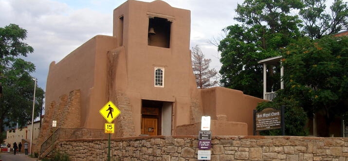
The Old Santa Fe Trail is an absolute favourite with runners in and visiting Santa Fe. The trail begins at the south side of the Santa Fe Plaza at the San Miguel Mission. Once it moves out of the Downtown area, the trail widens up to feature gorgeous rolling hills. It goes on for about 10 miles (16 kilometres) until you reach Canada de los Alamos out in the country, where it turns into a dirt forest trail. This trail is part of the legendary 900-mile-long (1,450-kilometre) Santa Fe Historical Trail.
Old Santa Fe Trail
Address: 401 Old Santa Fe Trail, Santa Fe, NM 87501
Trailhead: The trailhead lies right outside the San Miguel Mission in the Plaza, Santa Fe.
Length: 10 miles one-way (16 kilometre)
Difficulty: Easy
10. Dorothy Stewart Trail
The Dorothy Stewart Trail is a fantastic mountain biking trail for serious riders in Santa Fe. It begins atop the Wilderness Gate Road and continues further until it joins the South Dale Ball trail. The trail offers intrepid travellers two paths when they come upon a small mountain around 1 mile (1.6 km) into it. It has some rocky sections, quick descents, and tough climbs which are all doable for the fairly experienced and advanced riders. Going northward, the trail ends with a few steep switchbacks which go down the valley and connect with the South Dale Ball trails. Going south on the trail, it presents bikers with steep switchbacks that are quite demanding and testing.
Dorothy Stewart Trail
Address: 960002829, Santa Fe, NM 87501
Trailhead: The trailhead lies on Camino De Cruz Blanca, just before the Atalaya Upper Trailhead.
Length: 2.3 miles (3.7 kilometres)
Difficulty: Difficult
Into the great outdoors in Santa Fe
Santa Fe’s outdoors have something or the other for every kind of outdoorsman, whether its a hiker, trekker, runner, or a mountain biker. If you’re planning to visit Santa Fe, check out this list to see which trail suits you and enjoy your time out in the jaw-droppingly beautiful outdoors of New Mexico.
History
Get Trip101 in your inbox
Unsubscribe in one click. See our Privacy Policy for more information on how we use your data