
Holding Switzerland’s highest peaks, Zermatt is a municipality in the district of Visp. The place is popular with many trekkers and mountain climbers with its many trails and the Matterhorn mountain. Many famous people such as Theodore Roosevelt, Winston Churchill, and Edward Whymper have trekked and climbed the highest elevations of Zermatt. Booming in popularity, the place now has skiers cruising through the pistes while appreciating the breathtaking view from atop the great mountain. Just on the outskirts of the mountain are many shops, restaurants, hotels, and many other great attractions that visitors enjoy after trekking for miles. If you are planning to go there trekking, you might be overwhelmed by the number of available trails in Zermatt. To save you some time finding out the best trails in the area, we have compiled the top hiking trails in Zermatt, Switzerland. So stop stressing about it and continue reading below.
1. Zum See to Furi

The Zum See to Furi trails is an easy trail with approximately 0.6 kilometers (0.37 miles) from Zum See to Furi. The trail is characterized as being mostly flat, has small obstacles such as rocks and roots, and has potentially hazardous terrains making it not suitable for the first-time hiker. As for elevation, it starts from 1,769 meters above water level, and its highest ascent is up to 84 meters (275 feet) from base elevation. Taking the trail, hikers will go past houses and open terrain and will know they are close to the destination when the Furi chairlift is visible. Hikers taking the trail will be awarded beautiful views of green pastures, thin larch forests, rock formations, and rounded hillocks.
Zum See to Furi
Address: Zum See, 3920 Zermatt, Switzerland
2. Edelweissweg

The Edelweissweg is an Intermediate trail with 12.8 kilometers (7.9 miles) of trail from point to point. The trail is characterized as being mostly flat, has uneven terrain with moderate inclines, has roots and rocks as obstacles, and has an overly tricky terrain not suitable for beginners but not hard enough to be characterized as an expert hiker’s trail. The lowest elevation of the trail would be at 1,940 meters (6364 feet) from sea level, and peaking at 2,750 meters (9022 feet), with the ascent up to 488 meters (1601 feet) and descent as low as 903 meters (2962 feet) below. Hikers taking on the trail will have a great view of the Matterhorn and glaciers at the Zmuttback creek.
Edelweissweg
Address: 3920 Zermatt, Switzerland
3. Wisshorn - Trift

The Weisshorn to Trift trail is a 1.3-kilometer (0.8-mile) trail suggested to be suitable for intermediate-level hikers. The trail is characterized as mostly sloped, has small inclines, rocks and roots as obstacles, and have potentially hazardous terrain. Elevation would be at 2,360 meters (7,742 feet), peaking at 2,509 meters (8,231 feet) above sea level, having no ascents and descents going as low as -149 meters (-488 feet). Hikers of the trail will be rewarded with the view of Trift Valley, many wildflowers, glacier feed river, and a beautiful waterfall.
Wisshorn - Trift
Address: 3920 Zermatt, Switzerland
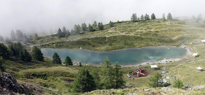
4. Leisee to Grindjisee

The Leisee to Grindjisee trail is a mostly steep hike of 1.3 kilometers (0.8 miles). The trail is characterized to have uneven trails, moderate inclines, has a potentially hazardous area, and is generally a tricky trail to hike. The elevation is at 2,219 meters (7,280 feet), peaking at 2,361 meters (7,746 feet), ascents go up to 142 meters (465 feet), and descents going as low as -20 meters (-66 feet). Hikers will walk past the Grindjisee Lake, wooden walkways, and will end at an access road.
Leisee to Grindjisee
Address: Leisee, 3920 Zermatt, Switzerland
5. Murini to Waldweg

Only going up, the Murini to Waldweg trail is a 1-kilometer (0.6-mile) trail graded as intermediate to difficult in terms level of difficulty. The trail is known to have moderate inclines, uneven terrains, with only rocks and roots as obstacles, and it has potentially hazardous areas. The elevation is at 1720 meters (5741 feet) and peaks at 1970 meters (6463 feet). The trail ascends up to 250 meters (820 feet) with no descents. Hikers will start on the Waldweg dirt road, head west to the forest where flora and fauna will be seen and will end at a dirt road trail.
Murini to Waldweg
Address: Mürini, 3920 Zermatt, Switzerland
6. Grunsee to Rifflelalp

A 2.4-kilometer (1.5-mile) trail suited for intermediate hikers, the Grunsee to Rifflelalp trail rewards hikers with a beautiful view of the mountains, flora and fauna, and mountain streams. The trail is characterized to be mostly flat, has small inclines, rocks and roots as small obstacles, and it is overall a tricky terrain not suited for beginners. The elevation is 2,206 meters (7,237 feet) peaking up to 2,281 meters (7,483 feet) above sea level, and having ascents up to 19 meters (62 feet), and descents as low as -95 meters (-312 feet). The trail will start from the Grunsee access road to the forest, then to a boulder field, and will end at the wide path along the train tracks at Riffelalp.
Grunsee to Rifflelalp
Address: Grünsee, 3920 Zermatt, Switzerland
7. Riffelberg Chapel Loop

Ranking at fifth place at the Zermatt trail rankings, the Riffleberg Chapel Loop is a looped trail that starts and ends at the same place. The trail is only 0.8 kilometers (0.5 miles) and is suited for intermediate hikers. It is known to be fairly flat, has uneven terrain with moderate inclines, and has potentially hazardous areas. Base elevation starts at 2,577 meters (8,454 feet) above sea level and peaks at 2,603 meters (8,540 feet), while ascents go up to 26 meters (85 feet) and descents as low as -23 meters (-76 feet). The trail starts at the Riffleberg Train Station, going right to the hill and small chapel, then goes left at an intersection, ending at a straight path completing the loop.
Riffelberg Chapel Loop
Address: 3920, 3920 Zermatt, Switzerland
8. Zen Steckenstrasse
The Zen Steckenstrasse trail is a 1.5-kilometer (0.9-mile) trail suitable for hikers at intermediate difficulty. The terrain is mostly flat, and it has small inclines and very few obstacles. The elevation starts at 1,619 meters (5,311 feet) above sea level, peaking at 1,765 meters (5,790 feet) and it has ascents of up to 146 meters (479 feet) and descents -2 meters (-6.5 feet) only. This trail starts from the shores of Matter Vispa village and it goes to a double-track leading to the steep Zermatt ski slope. Hikers will have a great view of many wildflowers, the hills, and the mountains.
Zen Steckenstrasse
Address: Zmuttweg, 3920 Zermatt, Switzerland
9. Riffelalp to Riffelberg

The Riffelalp to Riffelberg trail is a 2.5-kilometer (1.55-mile) trail suited for the more experienced hikers. The trail grants hikers a breathtaking view of the mountains, hills, and some wildflowers along the way. It is steep and only goes up, has uneven terrain with potentially hazardous areas. The elevation of the trail starts at 2,224 meters (7,296 feet) above sea level peaking at 2,563 meters (8408 feet), with ascents going up to 339 meters (1,112 feet) and having no descent throughout the hike. The hike will start from Riffelalp heading east to the mountains, then goes left to a flat path progressively inclining all throughout the hike until reaching the destination.
Riffelalp to Riffelberg
Address: Riffelalp, 3920 Zermatt, Switzerland
Get the best views of Zermatt

Many of the best views of Zermatt can only be found through hikes going to higher elevations. Having many trails to choose from, every person will find a great trail that will suit their experiences and what they want to achieve throughout the hike. The list of the trails above should give you some idea of how difficult the hike will be if you choose to take the hike. You can easily hike several of these trails since the majority of them are short yet yield great views of the beautiful Zermatt.
History
Get Trip101 in your inbox
Unsubscribe in one click. See our Privacy Policy for more information on how we use your data