
Located in the western region of USA, Colorado is a state offering beautiful desert, snow-covered Rocky Mountains and scenic river canyons. A visit to Rocky Mountain National Park offers opportunities for hiking, biking, and climbing, while Mesa Verde National Park is a fascinating place to be, with its Ancestral Puebloan cliff dwellings. Aspen is a renowned skiing destination in the winter months, with its beautiful Maroon Bells peaks to view. The state capital, Denver, is an exciting city to visit with its vibrant downtown area. Dubbed the “Mile High City,” there are a number of museums to explore and stadiums to enjoy the latest sports. For those with a love of outdoor living and exploring, the following are the top hiking and trekking spots in Colorado, USA.
1. Roxborough State Park

Roxborough State Park is located in Douglas County, a 20-mi (32-km) drive from Denver and is renowned for its dramatic red sandstone formations. The park was established in 1975 and was recognized as a National Natural Landmark in 1980. Throughout the park, a variety of wildlife can be seen, including mule deer and black bears, along with a number of distinct plant communities. Roxborough is ideal for hiking, trail running, wildlife viewing, bird watching, and photography. Please note no pets, camping, drones, horses, mountain bikes, rock climbing or fires are allowed in the park in order to preserve its natural resources. The various trails in the park range from easy to moderately difficult. Roxborough State Park can be accessed from North Rampart Range Road, just past Rosborough Village.
Roxborough State Park
Address: 4751 E Roxborough Dr, Littleton, Colorado, USA
Website: Roxborough State Park
Opening hours: 8am - 5pm (daily)
Price: 8 USD
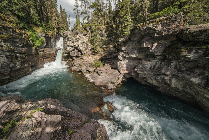
2. North Cheyenne Cañon Park

North Cheyenne Cañon Park is set in a 1,000-ft (304.8-m) deep canyon in the 1.5 billion-year-old granite rock. The park is located to the southwest of Colorado Springs. The park offers a great habitat for animals such as the black bear, mule deer, and mountain lion and a variety of birds, including the kingfisher, broad-tailed hummingbird, and American dipper. Visitors can hike, drive or bike along the bottom of the canyon next to the North Cheyenne Creek and there is a choice of trails to be followed. The gates to the park are located close to Starsmore Nature and Visitor Center on North Cheyenne Cañon Road. Dogs are allowed in the park but must be kept on a leash. The trails are considered to be moderate in difficulty and toilets are available at Helen Hunt Falls.
North Cheyenne Cañon Park
Address: 2120 S Cheyenne Canyon Rd, Colorado Springs, Colorado, USA
Website: North Cheyenne Cañon Park
Opening hours: Tue - Sat: 9am - 3pm (closed on Sun & Mon)
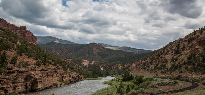
3. Arapaho and Roosevelt National Forests
The Arapaho and Roosevelt National Forests and Pawnee National Grassland are located in north-central Colorado and encompasses beautiful forests and grasslands, extending south of I-70 to Mount Evans, north to the Wyoming border and west from the Continental Divide to the Williams Fork Area. The area also includes a short grass prairie that lies east of I-25. There is a variety of outdoor opportunities in the park, including hiking, biking, and camping. The area also includes the beautiful Lake Isabelle, pictured here. Exploring the area can be moderate to challenging for hikers.
Arapaho and Roosevelt National Forests
Address: Denver, Colorado, USA
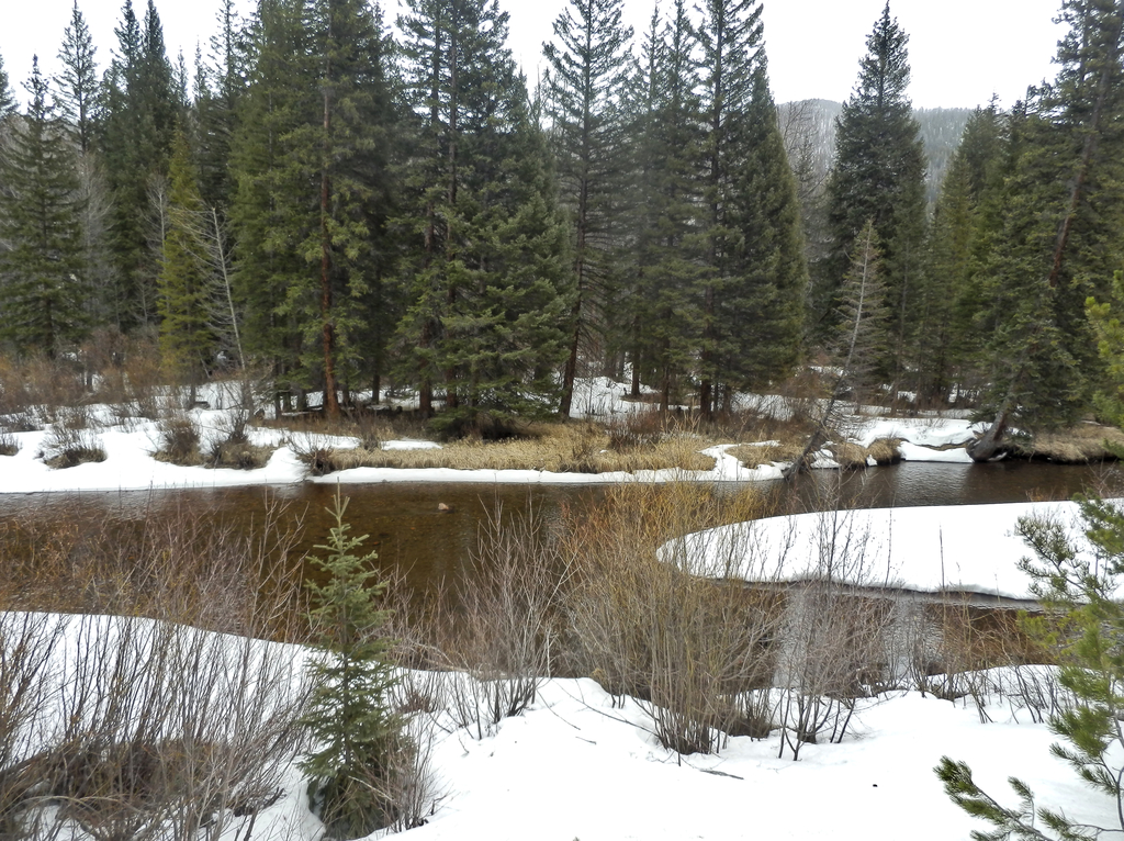
4. Rocky Mountain National Park


Located in northern Colorado, Rocky Mountain National Park spans the Continental Divide and includes forests, alpine tundra, and protected mountains. The most popular trails to follow are Old Fall River Road and Trail Ridge Road, both of which head through aspen trees and across rivers. Climbers will enjoy the Keyhole Route, a climb that crosses over vertical rock faces and heads up Longs Peak, the tallest mountain in the park. A picturesque trailheads around Bear Lake, offering spectacular views of the peaks. Hiking in the area is ideal for those who have experience of moderate hikes.
Book Tours : Rocky Mountain National Park Hiking
Colorado Tour Guide

Stephanie Eley
I'm a graduate of ITMI, International Tour Management Institute and 17 years as a licensed Tour Director and Program Director. My expertise began in NYC and Washington, DC where I'm a licensed guide and has expanded to Europe, South America, Cuba and the Western / Southwestern National Parks of the US. I'd love to introduce you for a day or a week to Denver, Colorado and the 4 corners region of... Read more
Tours by Stephanie


5. Palmer Park

Palmer Park is located in Colorado Springs and is a regional park located at 3650 Maizeland Road, a number of miles from the downtown area. In 2017, the park was named Best Urban Park in the Best of the Rockies list. Visitors will pass through beautiful grasslands with wildflowers and can enjoy the shade of the cottonwoods next to the creek. The park is particularly beautiful during the fall. There are many opportunities for recreation in the park, including hiking, watching wildlife and birds and trekking. Dogs are allowed in the park, but should be kept on a leash and excrement must be removed by the dog’s owner.
Palmer Park
Address: 3344-3376 Paseo Rd, Colorado Springs, Colorado, USA
Website: Palmer Park
Opening hours: Mon - Fri: 9:30am - 6pm; Sat - Sun: 7am - 9pm
6. Lair o’ the Bear Park
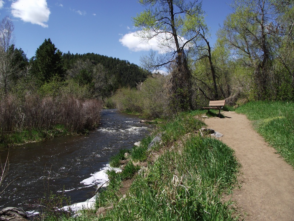
Lair o’ the Bear is a great family day-hike close to Denver, Colorado. The beauty begins in the drive into Canyon on Bear Creek Road. In the park itself, there are a number of hiking trail options to follow including next to Bear Creek, pictured here. There is plenty of parking near the start of the hike and a number of picnic spots, some in the open and others in the shade of the trees. Besides hiking, this trail is perfect for mountain biking. This easy hike takes around 1 hr 15 min to traverse the 1.6 mi (2.6 km) out and back. For a more challenging hike, traverse a 12.6-mi (20-km) round trip on Bear Creek Trail, which passes through three Denver Mountain Parks on the west side. Dogs are allowed, as long as they are kept on the leash. Fishing is available in Bear Creek.
Lair o’ the Bear Park
Address: CO-74, Idledale, Colorado, USA
Website: Lair o’ the Bear Park
Opening hours: 6am - 7:30pm (daily)
7. Intemann Trail
The Intemann Trail, or to give it its full name The Paul Intemann Memorial Nature Trail, is a 14-mi (8.6-km) easy to moderate hike from point to point. The challenge is intermediate and heads through Iron Mountain Open Space, offering a connection between the trail in western Colorado Springs with the Manitou Springs trails. If starting from the Palmer trailhead in Colorado Springs, the trail heads west for approximately 1 mi (1.6 km). The trail heads to the right through grasslands before eventually entering the forests. The trail continues down to Crystal Park Road and a lovely stream. The trail then picks up again on the other side, climbing steeply until it levels out around Iron Mountain, before heading back behind Manitou Springs.
Intemann Trail
Address: 526 S 26th St, Colorado Springs, Colorado, USA
Website: Intemann Trail
8. St. Mary's Falls Trail
St. Mary’s Falls Trail is an easy, out and back trail that runs for 6.3 mi (10 km) and is located close to Colorado Springs. The trail is rated as moderate and features a waterfall. The trail is mostly used between April to October for hiking and mountain biking. Dogs are allowed, as long as they are kept on a leash. To get there, take either Cheyenne Road or 26th Street to North Cheyenne Canyon Road and then onto Gold Camp Road. The trailhead is located approximately 1 mi (1.6 km) past a gate where North Cheyenne Canyon Road meets Gold Camp Road and High Drive
St. Mary's Falls Trail
Address: Colorado Springs, Colarado, USA
9. Mt. Cutler and Muscoco Trailhead

Mt. Muscoco Trail runs for 3.7 mi (6 km) and is an out and back, moderate trail located close to Colorado Springs. The trail offers lovely wildflowers and there is a beautiful view from the top. The trail is best taken between May and November. Dogs are allowed, as long as they are kept on their leash. The Mt. Muscoco trailhead is at the same spot as the Mt Cutler trailhead and they are the same trail until they split after around half a mile (0.8 km).
Mt. Cutler and Muscoco Trailhead
Address: N Cheyenne Canyon Rd, Colorado Springs, Colorado, USA
Website: Mt. Cutler and Muscoco Trailhead
10. Red Rock Canyon Open Space

Red Rock Canyon Open Space is a city park on the west side of Colorado Springs, next to Manitou Springs and to the south of US Route 24. The canyon features a series of ridges and canyons and offers sheltered enclaves and beautiful views. A number of animal and plant communities thrive in the park and its history includes stone quarries and gold mills. There are a number of trails through the park and activities include moderate hiking, cycling, horseback riding, and climbing and there are a number of picnic areas available.
Red Rock Canyon Open Space
Address: 3550 W High St, Colorado Springs, Colorado, USA
Website: Red Rock Canyon Open Space
Opening hours: 5am - 9pm (daily)
11. Bear Peak
Contributed by Content Creator, Nicki Post
Source: Nicki Post


I was in the mood for a challenge when I decided to do this hike. I had heard it’s pretty difficult so saved it for a day when I had some time.
PARKING: You can either park at the NCAR parking lot, follow the Mesa Trail and go up Fern Canyon to the peak, or park in the neighborhood on Cragmoor Street (just off of Lehigh on the way to NCAR) and go up along Shanahan Ridge. I did the latter.
THE TRAIL: The trail immediately starts to incline, and it’s a steady and continuous ascent up. The beginning of the trail is even and wide but eventually begins to narrow as you enter the denser part of the forest. Then, you’ll be climbing up large rocks as you zig-zag your way up. The last hour is nearly a straight incline on big rocks and boulders and requires some scrambling. The last push to reach the absolute peak is definitely a scramble, but worth it. You get amazing 360-degree views up top. You can also see South Boulder Peak from Bear Peak.
THE TIME AND DISTANCE: It took me about 2 hours and 30 minutes to reach Bear Peak from the Cragmoor Trailhead. Coming back down took nearly an hour. I did spend a lot of time up top to have a snack and enjoy the views. I also added more time to the trip because I ended up heading over to South Boulder Peak.
DIFFICULTY LEVEL: This is a difficult hike to be sure. I went slow and steady, wanting to conserve my energy for the final push. Be prepared for lots of rocks and some scrambling towards the top.
WHAT TO BRING: Water, snacks, hat, SPF, good shoes. I drank 2 liters on this hike.
WHAT TO WEAR: Clothes you feel comfortable moving in. It gets windy and cold up top so make sure to bring a windbreaker or jacket.
12. Royal Arch
Contributed by Content Creator, Nicki Post
Source: Nicki Post


Royal Arch is a great hike near Boulder, with incredible views looking down over the city.
PARKING: You can park in the Chautauqua parking lot, but you’ll need to pay for hourly parking. The parking along Baseline Road and the nearby neighborhoods have free parking between Labor Day and Memorial Day.
THE TRAIL: Follow the Bluebell Road trail up towards the Bluebell shelter. From there, the trail is very well marked with easy instructions to reach the peak and see the arch.
THE TIME AND DISTANCE: The trail is about 3 miles total, up and back. It took us about 3 hours, but we also spent a lot of time eating snacks up at the peak.
DIFFICULTY LEVEL: This is an intermediate to advanced hike. There are lots of rocks and stairs you need to climb.
WHAT TO BRING: Water, snacks, hat, SPF, good shoes
WHAT TO WEAR: Clothes you feel comfortable moving in.
Get out into the fresh air in Colorado
Besides visiting the cities, including Denver and Colorado Springs, both of which have plenty of attractions and museums to visit, this state is perfect for getting out on the nature trails and hiking adventures. Check out the top hiking and trekking spots in Colorado, USA.
History
Get Trip101 in your inbox
Unsubscribe in one click. See our Privacy Policy for more information on how we use your data